MAS Perrine
Presentation of the PhD project
In France, heating networks are largely dependent on fossil fuels (42%), and deep geothermal energy represents less than 5% of the energy mix of heating networks [1]. Deployment of geothermal energy in large cities is limited by a geological risk, which is difficult to predict.
The Région Ile-de-France energy-climate strategy has established the objective of producing 37TWh of renewable energy by 2030 [2], i.e., twice the current production (18TWh). This strategy targets to increase deep geothermal heat production to 3TWh, representing 8% of the renewable energy produced in Ile-de-France in 2030, a 3.5 factor higher than in 2015 [2]. As some aquifers are actually intensively exploited in Ile-de-France, the challenge will be to increase by a factor of 3.5 the heating networks using geothermal energy by targeting new potential area. In addition, there is a real risk that an installation may not reach a geothermal resource with sufficient flow and temperature characteristics to ensure the cost-effectiveness of the project during its life time [2]. This risk constitutes a real obstacle for the future development of geothermal energy in Ile-de-France.
In Ile-de-France, Two main deep (between 0.2 km and 2 km) geothermal aquifers are exploited using geothermal doublets for heating networks: (1) the Middle Jurassic limestones (55-80°C) and (2) the Early Cretaceous sandstones (30-35°C).
This project will work on innovative modeling methods by proposing solutions that optimize and explore the development of new areas in the Paris Basin. The optimization of the use of deep geothermal energy is a major challenge for the Région Ile-de-France, which has a population of nearly 12 million inhabitants.
This optimization of geothermal production of aquifers requires (1) precise knowledge of the reservoir heterogeneity in terms of sedimentary geometries, porosity/permeability, reservoir connectivity and (2) reliable numerical simulations of flows and temperature evolution in the underground 30 years or even 100 years after production starts [3]. In order to reach the objective defined by the Ile-de-France region in its “energy-climate” strategy [2] by reducing the risk of future operations as much as possible. For investors, often who are often from the public domain (municipalities or communities of municipalities), it is becoming urgent to have a reliable and precise numerical geological model, making it possible to predict the thermal and hydrological evolution of the aquifers. A well-defined stratigraphic architecture would reduce these risks by allowing precise water and heat flow simulations, identifying the influence by geostatistical distributions. This simulation will be done at the finest possible scale, taking into account the heterogeneity of sedimentary facies, porosity, diagenetic alterations, stratigraphic architecture, relationships with fracturing and the study of field analogues (outcrops).
Research area
Sedimentary geology reservoir and geothermal energy
Research objectives
The objective is to develop a tool that predicts the performance (sedimentary basin) of the geothermal potential in terms of flow, productivity, temperature, and energy conservation from analogous field reservoirs, wells and modeling, at a given location. It is a question of being able to provide a tool to assist the investors in the decision for the installation of future geothermal wells by giving risk criteria to be taken into account for the project.
The main objective of this thesis project will be to propose a reliable 3D geological model of the stratigraphic geometries and the porous network to simulate the flow on the target zones (multi-kilometres). We wish to focus mainly on the study of the fine characteristics of siliciclastic geothermal reservoirs (Triassic and Early Cretaceous sands) in the Ile-de-France region by comparing with field analogues in France, Spain and USA.
Logs, cores and cuttings
A database compiling the logs and petrophysical data of 80 wells on a zone from South Paris to Melun is available at GEOPS on Petrel©. It will be necessary to input this database with data from the subsurface bank (http://infoterre.brgm.fr/). Two reference wells will be sampled (Bobigny and Saclay) and analysed in terms of facies, petrography and petrophysics (porosity, permeability, NMR). We plan to process the NMR logs of the available wells by cross-referencing the petrographic analysis of facies and pore types with the detailed study of thin slices. The goal is to conceptualize the geometry of reservoir bodies. The thesis project also aims at comparing the logs and facies of these wells in order to propose a rock typing of the Early Cretaceous sands and of the Triassic sandstone facies using EasyTrace.
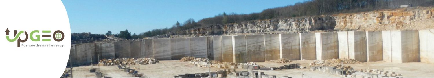
Outcrop investigations as reservoir analogs
The outcrops closest to the Paris region, are currently under study (Cuy-Saint-Fiacre, Seine-Maritime) and can be considered as analog to the reservoirs under Paris. 3D photogrammetry has been successfully tested and optimized by GEOPS to fit with inherent constraints due to field acquisition. A drone overflights acquisition associated with photogrammetry is in progress to provide an accurate stratigraphic model of the outcropping reservoir analogues and we plan to acquire images on two other field analogues: (1) an exceptional analogue of estuarine/deltaic sandstones (Sego Formation, Late Cretaceous, Colorado, USA), (2) Miocene deposits from the subalpine basin and in (3) Eocene deposits from the South Pyrenean Basin [4]. This will lead to the construction of 3D digital outcrops models with Virtual Reality Geological Studio (VRGS : https://www.click2go.umip.com/i/s_w/vrgs.html), capturing sedimentary heterogeneities at decimetre to kilometre scales, which will subsequently be used for reservoir flow modelling [5].
Statistic model on the Petrel geomodeler
Well and outcrop study data will allow 3D static modelling of the reservoir architecture using sequence stratigraphy concepts and statistical analysis of sample observations. The comparison of geological observations with 3D models of outcrops will provide an opportunity to develop different stratigraphic patterns that will serve as a basis for 3D geological modelling of reservoir properties (porosity and permeability). On the basis of the statistical models that will be obtained, 3D numerical models of outcrops will be constructed to capture sediment heterogeneity at decimetric to kilometric scales for reservoir flow modelling [5]. This modeling is a prerequisite for performing in-layer flow tests (using Tough2, PumaFlow or Eclipse).
Methodology
To sum up, the main methods of UPGEO will be:
Well-log description
- Use well-logs, especially NMR, and cuttings/plugs/core for µCT scan to characterize the facies, microstructure and petrophysical properties of the studied rocks.
Fieldwork
- Integrate data from outcrop analogues by drone photogrammetry acquisition into 3D reservoir models with PIX4D, Virtual Reality Geological Studio et Petrel
Geological modeling
- Use of geostatistics to populate facies and stratigraphic geometries of carbonate and siliciclastic reservoirs.
- Propose new concepts of reservoir connectivity, from geostatistical models, to increase reliability of flow simulations.
- Use the softwares PIX4D, Virtual Reality Geological Studio and Petrel to characterize outcropping reservoir analogues – – Use Petrel to propose properties modeling
- Develop predictive models for flow simulation in clastic geothermal sedimentary system with ECLIPSE and PUMAFLOW.
- Provide an innovative workflow for simulation applicable to other sedimentary basins.
Expected results
- – 3D outcrop models, identification of facies or geobodies which could be considered as one reservoir cell
- – Facies, sequence stratigraphy and petrophysics (NMR, porosity, and permeabilty on about 100 plugs, about 10 digital 3D micro-scale RVE from µCT scan of reservoir rock fabrics, about 10 rock fabrics expected)
- – Type of statistics to be used to fill the empty cells between wells or to populate the properties (facies, petrophysics)
- – 3D Geological geostatistical model (3D grid)
- – Simulation hydrodynamique sur Eclipse et PumaFlow
Thesis supervision
Benjamin Brigaud (Géosciences Paris Sud, Université paris-Saclay) and Raphaël Bourillot (GéoRessources & Environnement, Bordeaux INP)
Context of the research project
This PhD is part of ANR UPGEO « UPscaling and heat simulations for improving the efficiency of deep GEOthermal energy » funded by the French Research Agency (ANR). The PhD project will be funded by the ANR.
UPGEO is a geothermal research program funded by the Agence Nationale pour la Recherche, between the University Paris-Saclay, University of Lyon, Bordeaux INP, BRGM, IFPEN and Geofluid http://hebergement.universite-paris-saclay.fr/upgeo,
Collaborations envisagées
Collaboration possible with UPGEO
Géosciences Paris Sud (GEOPS), Université Paris-Saclay/CNRS, Orsay, France
Laboratoire de Mathématique d’Orsay (LMO), Université Paris-Saclay/CNRS, Orsay, France
Laboratoire des Sciences du Climat et de l’Environnement (LSCE), Université Paris-Saclay/CNRS/CEA, Gif-sur-Yvette, France
Institut Camille Jordan (ICJ), Université Lyon/CNRS, Lyon, France
Géoressources & Environnement (G&E), Bordeaux-INP-Université Bordeaux Montaigne, Bordeaux, France
BRGM, Orléans, France
IFPEN, Rueil-Malmaison, France
GEOFLUID, Roissy, France
References
[1] Pécresse, V., 2018. Stratégie Énergie-Climat de La Région Île-De-France. Rapport n°CR 2018-016, 74 pages
[2] Ministère de l’Environnement, de l’énergie et de la mer en charge des relations internationales sur le climat, 2017. Chiffres clés de l’énergie, Edition 2016. 71 pages
[3] Willems, C. J., Nick, H. M., Donselaar, M. E., Weltje, G. J., Bruhn, D. F., 2017. On the connectivity anisotropy in fluvial Hot Sedimentary Aquifers and its influence on geothermal doublet performance. Geothermics, 65, 222-233.
[4] Andrieu S., Brigaud B., Barbarand J., Lasseur E., 2017. Linking early diagenesis and sedimentary facies to sequence stratigraphy on a prograding oolitic wedge: the Bathonian of western France (Aquitaine Basin). Marine and Petroleum Geology. 81, 169-195.
[5] Cabello, P., Domínguez, D., Murillo-López, M. H., López-Blanco, M., García-Sellés, D., Cuevas, J. L., Marzo, M., Arbués, P., 2018. From conventional outcrop datasets and digital outcrop models to flow simulation in the Pont de Montanana point-bar deposits (Ypresian, Southern Pyrenees). Marine and Petroleum Geology, 94, 19-42.